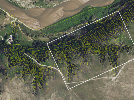
Compared to more forested regions, less is known about the semi-arid, boundary forests of grassland regions. Situated in a climate challenging to tree growth, these patchily distributed forests form at the prairie-forest ecotone in the USA. Boundary forests are often characterized by fine-grain heterogeneity in climatic, hydrologic, and edaphic conditions that influence the local microenvironments, which, combined with fire, exert strong control on vegetation distribution. The Niobrara plot is one of two forest plots in Nebraska that explore the prairie-forest ecotone (the other is the Indian Cave plot).
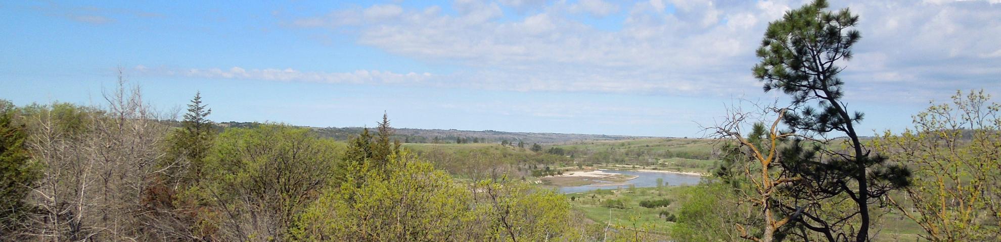
The Niobrara plot sits in a distinctive boundary forest system in the Great Plains, USA, and encompasses a sharp transition from sand-hills prairie to forest. The forest occurs in moist, cool, spring-fed canyons leading to the Niobrara River that offer a stark contrast to the dry, well drained adjacent sand hills prairie. The forested canyons house biogeographically unique combinations of tree species, some of which are found virtually nowhere else in the State, including paper birch (Betula paperifera) and Ponderosa pine (Pinus ponderosa).
Longitude: -100.021000000000