
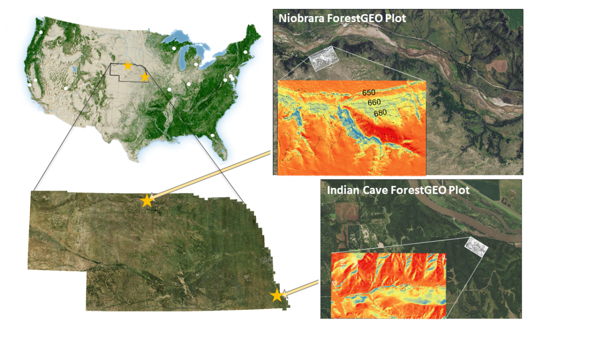
ForestGEO adds two research sites at the forest-prairie transition zone
ForestGEO sites represent tropical, temperate, and boreal forests, and with the establishment of Niobrara and Indian Cave plots in Nebraska, USA, the network adds a new type of ecosystem to its list: the transition zone between forest and prairie grassland, a unique and understudied ecosystem. In addition to advancing understanding of this important transitional habitat, the new plots expand the ForestGEO network by adding two midwestern-US data points with climatic conditions not found in the other temperate forest plots in North America.
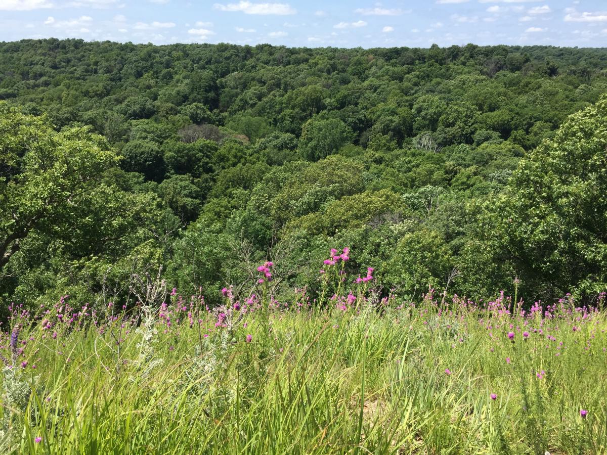
The two Nebraskan plots sample regions that are considered “biogeographic crossroads,” since elements of the boreal, eastern deciduous, and Rocky Mountain forests meet in them, making them biologically unique for both plants and wildlife.
The forest-prairie transition zone traverses the edges of habitat and geographic ranges for flora and fauna. As such, these zones are particularly well-suited to address research questions regarding abiotic and biotic drivers of habitat and geographic range boundaries. Informed conservation requires understanding of such drivers, and since these boundaries may shift with climate change, Niobrara and Indian Cave ForestGEO sites are primed to contribute to the effort.
The emergence of the Rocky Mountain Range 60 million years ago initiated a rain shadow effect, causing reduced rainfall on its eastern side. Here, grasses dominate, forming the vast prairie landscapes for which the midwestern region of North America is known. Given the scarcity of water, as well as the presence of strong winds and fire, trees typically do not grow in this region. The exceptions are where soil water is more available, such as near rivers, or in sheltered valleys. The Niobrara plot is situated in the valley of the Niobrara River, where seeps and springs facilitate the growth of broad-leaved, moist forest species, and plants are sheltered from hot, desiccating summer winds from the south. The Indian Cave plot is situated in the bluffs along the Missouri River, where many more southerly distributed mesic forest species extend their distributions northward along the river valley, and more easterly distributed species reach their western geographic range limit.
Dr. Sabrina Russo, Professor of Biology at the University of Nebraska-Lincoln, is the Principal Investigator of the Niobrara and Indian Cave sites. Since 2018 she has worked with 12 students and interns to establish the plots and conduct their first censuses. The Niobrara census began in May 2018 and concluded in July 2019. The Indian Cave census began in July 2019 and was completed in early 2020, with some delays due to the COVID-19 pandemic.
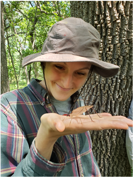
has also been a member of the field crew at both Niobrara and Indian Cave.
Bailey McNichol, a PhD student of Dr. Russo’s, said, “I am a field biologist at heart, so I was particularly excited about the ForestGEO plots because they involve a great deal of field work and allow for large-scale, comparative studies of forest dynamics to be carried out.” Commenting on the unique value of Niobrara and Indian Cave as research sites, Bailey said, “As forest distributions in Nebraska are constrained by water availability, I think there are a lot of important questions that need to be addressed in regard to what might happen to these forests under future climate change scenarios that predict large interannual fluctuations in precipitation (flood/drought years) and temperature regimes.” Her dissertation research is focused on characterizing local-scale species diversity and distributions, linking these to larger-scale distributions across species’ geographic ranges, and understanding variation in woody species’ ecological strategies along the sharp environmental gradients in the Niobrara plot.
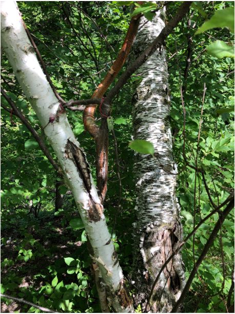
America’s Last Glacial Maximum are present at the Niobrara site. Photo credit: Sabrina E. Russo
Establishing a new research site requires a great investment of time, effort, and funding from a collection of partners. In addition to support from the University of Nebraska-Lincoln and from the Nature Conservancy, these two sites were made financially possible by a generous gift from Jacqueline B. Mars. The new sites are already providing opportunities for research by undergraduate students and interns, giving them experience in important skills including data collection, analysis, and science communication. The plots are valuable platforms for a range of other research, conservation, and management efforts, including restoration of oak woodlands using prescribed fire, wildlife habitat use, and the effects of invasive species. And perhaps most uniquely, at the intersection of forest and prairie, Niobrara and Indian Cave are poised to document the shifting boundaries that climate change promises to bring.
In January 2021 Bailey McNichol presented on the Niobrara plot at ForestGEO’s Seminar Series. To request access to the recording, please be in touch with Caly McCarthy, ForestGEO Program Assistant: mccarthyc@si.edu.