
Spotlight Series: KC Cushman & the Quest to Measure Big Trees
KC Cushman is a postdoctoral fellow with the NASA’s Jet Propulsion Laboratory. She was formerly a fellow with the Smithsonian Tropical Research Institute (STRI) and Next Generation Ecosystem Experiments-Tropics in the lab of ForestGEO Staff Scientist Helene Muller-Landau. KC has done fieldwork at six ForestGEO plots, she appreciates the interdisciplinary nature of forest ecology, and she has a perfect cat named Arden.
When did you realize you wanted to be a scientist/work in forest ecology? How did you decide to go down this career path?
I was very broadly interested in science as an undergraduate. I did a major in general biology and minors in engineering and math, and I was interested in finding some area of study that could combine all of those things. My undergraduate thesis project was actually about the biomechanics of barnacle feeding—quite different from what I’m doing now! During my senior year, I took an ecology class with Jose-Luis Machado (who himself worked at Barro Colorado Island [BCI] during his PhD) and learned that forest ecology research could be very interdisciplinary, combining natural history with math and sometimes technical fields to creatively measure trees. At the time, I was also involved in a lot of student groups focused on sustainability and environmental justice, and I was drawn to the idea of doing research that was relevant for understanding global climate change.
When did you first get involved in the ForestGEO network?
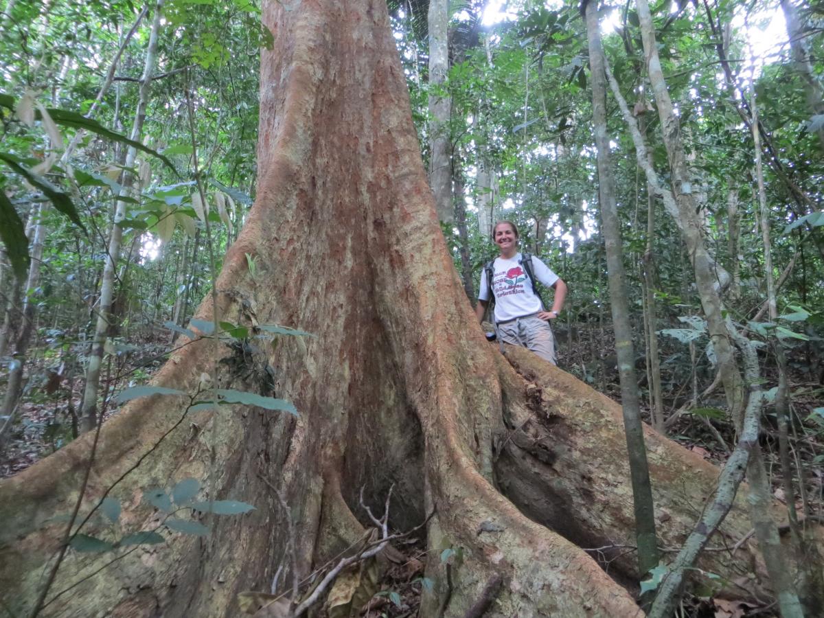
I first joined ForestGEO as an intern with Helene Muller-Landau at STRI in 2012, working with the ForestGEO carbon research initiative. My plan after college was to do a few short-term fieldwork jobs to see what I liked and wanted to continue with. My initial appointment was for six months, but I loved working with ForestGEO so much that I stayed for two years, and then returned to STRI after completing my PhD in 2020! Beyond my own research, ForestGEO workshops and STRI seminars were so important for meeting scientists from other institutions around the world, and for learning about other sites and areas of research. During my internship, I was able to do a project measuring and comparing tree trunk shape across five tropical sites (Amacayacu, BCI, Bukit Timah, Khao Chong, and Huai Kha Khaeng) through the ForestGEO Research Grants program. It was so valuable for me to see these different forests, and especially to work with and learn from collaborators at each site. I also had the opportunity to do some fieldwork with the Blue Cat group at the Zofin ForestGEO site during my PhD, and that was a real highlight of grad school for me!

What led you down the path to your current job? What has been your biggest challenge in getting to this point in your career?
During my internship with ForestGEO, I was measuring forest structure on the ground. I love being in the field, but I also found it somewhat unsatisfying to spend a long time trying to measure a few big trees imprecisely. At the same time, through visitors to STRI, I was learning about new drone remote sensing methods that allow for really detailed measurements of forest structure and biomass quickly over large areas. I chose a lab for my PhD that would allow me to combine ecology and remote sensing, and I have continued to work in that area.
My biggest challenge was absolutely learning how to manage anxiety. That has always been a challenge for me, but I didn’t think of anxiety as something that seriously interfered with my performance at work or school until I was working on my PhD. A number of factors contributed to that including bad luck with research projects, isolation in my program, and the social dynamics of starting to work in remote sensing, which is still a pretty male-dominated field. Fortunately, I was able to work with a great therapist through my university—and ForestGEO colleagues were also really valuable in helping me feel less isolated during that time! I think my experience was not uncommon, and I think it is important to talk more about developing a culture that supports the mental health of people in science.
What is the most interesting or unique aspect of your site?
One aspect that I really like about BCI and Zofin is that both sites have a history of facilitating cool methods’ development. In addition to the standard tree stem map, there are so many other layers of data available for the BCI plot—like measurements of tree heights, crown area, liana coverage, leaf inclination angle—and I really enjoy seeing how those data are incorporated into new projects to bring fresh insight into the ecology of even the most well-studied sites. A fun fact I love to share from the Blue Cat group: while BCI was the first official ForestGEO site, the oldest known stem map is from one of their sites in Czechia, Boubín, from 1851.
What questions are you currently addressing in your research/site?
We recently published a manuscript from my main project during my recent postdoc with ForestGEO and NGEE-Tropics. In that project, we used drone images over all of BCI spanning five years to locate canopy disturbances, and to model how disturbance rates relate to soils, forest age, and topography. We found that there is variation in disturbance rates even across BCI—and that different disturbance rates are associated with variation in overall forest height across the island.

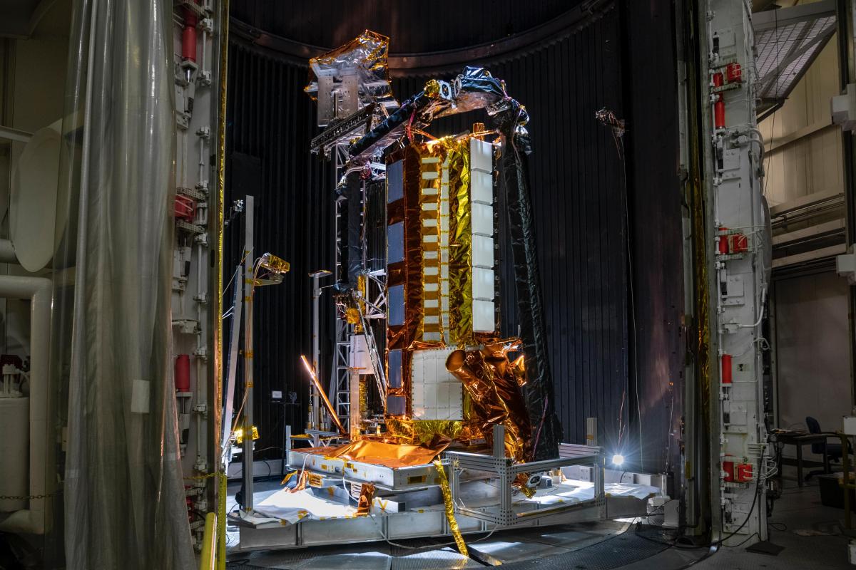
I just started a new postdoc position at NASA’s Jet Propulsion Laboratory (JPL), and my research at JPL is in support of the NASA-ISRO Synthetic Aperture Radar satellite mission (NISAR), which will launch in a couple years. NISAR will collect vegetation structure data (among other data products!) over the whole Earth every 12 days. My role is to use existing plot and 3D structure data from different tropical, temperate, and boreal ecosystems to help create and validate the models that NISAR will use to estimate biomass. Essentially, how can we use NISAR data to measure the carbon stored in global ecosystems? And how does ecosystem carbon change over time?
What kind of capacity building opportunities does your site provide for students, early-career researchers, and the local community?
STRI and BCI have a few opportunities to highlight for these groups! STRI and the Smithsonian have a number of fellowships and internships that allow undergraduates, graduate students, and/or postdocs to do research at STRI, including on BCI. Some of those opportunities support Panamanian students specifically, and some are open to anyone. I first came to STRI by contacting Helene about applying for a STRI internship—I actually applied twice because I wasn’t awarded the internship from my first application, so I encourage prospective applicants to ask for feedback and apply again if it doesn’t work out on your first try!
I wasn’t personally involved, but this also seems like a great place to mention the recent blog post describing a collaboration between ForestGEO’s Panama Team, McGill University scientists, and members of Panama’s indigenous Emberá community.
What is your favorite part about your work?
The diversity and complexity of forests make these ecosystems beautiful places to work…and also challenging subjects to study! My favorite thing is to be able to draw on my experiences in the field to come up with creative solutions to better measure and understand forests using remote sensing tools.
What do you like to do when you’re not studying forest dynamics?
I love cooking, reading (mostly contemporary fiction), and telling my cat, Arden, that she’s perfect. I’m often outside running or hiking—but I have also watched about 20 old seasons of Survivor during the pandemic, and for the last ~ five years I have coordinated a Bachelor franchise fantasy league competition for my friends and family!

Web Presence: Twitter
Selected Publications
Cushman, K. C., Detto, M., García, M., and H. C. Muller-Landau. (2022). Soils and topography control natural disturbance rates and thereby forest structure in a lowland tropical landscape. Ecology Letters. DOI: 10.1111/ele.13978
Cushman, K.C., Bunyavejchewin, S., Cárdenas, D., Condit, R., Davies, S., Duque, A., Hubbell, S., Kiratiprayoon, S., Lum, S., and H. C. Muller-Landau. (2021). Variation in trunk taper of buttressed trees within and among five lowland tropical forests. Biotropica, 53(5): 1442-1453. DOI: 10.1111/btp.12994
Muller-Landau, H., Cushman, K. C., Arroyo, E., Martinez, I., Anderson-Teixeira, K., and B. Backiel. (2020). Patterns and mechanisms of spatial variation in tropical forest productivity, woody residence time, and biomass. New Phytologist, 229: 3065–3087. DOI: 10.1111/nph.17084
Krůček, M., Král, K., Cushman, K. C., Missarov, A., and J. R. Kellner. (2020). Supervised Segmentation of Ultra-High-Density Drone Lidar for Large-Area Mapping of Individual Trees. Remote Sensing, 12(19): 3260. DOI: 10.3390/rs12193260
Augspurger, C. K., Franson, S. E., Cushman, K. C., and H. C. Muller‐Landau. (2016). Intraspecific variation in seed dispersal of a Neotropical tree and its relationship to fruit and tree traits. Ecology and Evolution, 6(4): 1128-1142. DOI: 10.1002/ece3.1905
Cushman, K. C., Muller‐Landau, H. C., Condit, R. S., and S. P. Hubbell. (2014). Improving estimates of biomass change in buttressed trees using tree taper models. Methods in Ecology and Evolution. 5(6): 573-582. DOI: 10.1111/2041-210X.12187