
ForestGEO employs plot censuses to achieve its mission of advancing long-term study of the world’s forests. Two members of the ForestGEO staff, David Mitre and Milton Solano, recently made achieving this mission much more efficient. Read on to learn about David and Milton’s work which led to their Smithsonian Award for Excellence in Digital Innovation. Haga clic aquí para leer el blog en español.
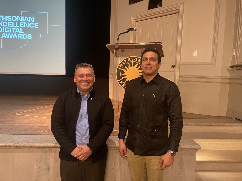
Excellence in Digital Innovation ceremony in Washington, DC.
The census of a ForestGEO Forest Dynamics Plot is an intensive process. The protocol entails identifying, mapping, tagging, and measuring every stem larger than 1cm in diameter. It requires a multi-person team that spends countless hours in the field collecting, transcribing, and analyzing data. The census can take upwards of a year and a half. At least it used to…
Enter David Mitre and Milton Solano. David is the ForestGEO Research Manager based in Panama. He has been involved with the plot census of Barro Colorado Island since he was a Plant Biology student in 2005. With almost 20 years of experience conducting field research on BCI, David’s invaluable field experience led him to recognize an opportunity for optimization. Milton, a GIS Analyst and Geographic Database Custodian, has been with STRI since 2007 working with geographic analysis, map preparation, and app development. In 2016, armed with years of expertise in ArcGIS, he started proposing ideas to improve the capture of information in the field.
David and Milton spent four months conceptualizing, developing, and testing an app system using the ArcGIS “Collector” program (now “Field Maps”) and tablets to digitally capture data in the field in real-time. The resulting app has already left an overwhelmingly positive impact on the ForestGEO community. In addition to Barro Colorado Island, three other ForestGEO plots – Mpala in Kenya, Amacayacu in Colombia, and SERC in Maryland – have already implemented this tool for their censuses, achieving the same optimized results. David and Milton’s success was recognized by the Smithsonian, earning them the award for Excellence in Digital Innovation. They both attended the awards ceremony in Washington, DC on October 16.
We followed up with David (DM) and Milton (MS) to learn more about their award-winning app. See what they had to say below.
What made you realize you wanted to initiate this change? Was there one defining moment or did the idea formulate over time?
MS: I first proposed using ArcGIS Collector for tree census data collection around 2016. Despite the ForestGEO team's previous negative experiences with field applications, I remained convinced of GIS's potential to revolutionize the process. In late 2021, as Collector evolved into the more robust Field Maps post-pandemic, I recognized a prime opportunity. Despite initial resistance, I collaborated with David Mitre to champion the implementation of this new tool.
DM: The idea of developing a digitalized system to eliminate the use of paper forms and be more efficient had been around for several years. An unsuccessful attempt was made to implement the same approach during the 2010 census. From 2018 to 2019, we used tablets and the Google Sheets program, and then Excel...However, we still had to carry printed maps, and these programs presented many inconveniences…During the Covid lockdown in 2020, we established communication with STRI ArcGIS specialist Milton Solano, where he introduced us to the functionalities of the ArcGIS system and its Collector App. I started the process of a pre-conceptualization (see drawings on napkins) of the structure that should be given to the system so that it would be compatible with our field methodology, help us reduce field errors, and be user-friendly. Milton was in charge of programming the app and the try-outs and fine-tuning of it began, to be later implemented during the 10th census of the BCI 50ha plot in 2022.

ensuring a clearunderstanding of the data collection process.
In non-technical terms, how does the ArcGIS application work? Are there any parts you’d like to highlight?
MS: Imagine having a map that not only shows you where things are, but also lets you add information to it. For example, if you're a scientist studying trees, you could use it to mark where each tree is, measure its size, and take pictures. It's like having a digital notebook that's always with you, helping you collect data and make sure it's accurate. And the best part? You can do all this without needing an internet connection!
To effectively function in remote plot locations without internet connectivity, the Census Application was designed to operate offline. It incorporated a base map displaying trails, plot boundaries, markers, trees, and stems. To minimize data entry errors, intelligent data editing features were implemented. Additionally, a visual progress indicator was integrated, using color-coded trees to represent census completion status. Fieldworkers utilized tablets (iPads or Android) equipped with ArcGIS Field Maps to conduct data collection. To ensure offline functionality in remote plot locations, census maps were prepared and downloaded to each device at the office, using provided access credentials.
DM: I would like to highlight that the ability to establish quality controls or validations that will help us reduce errors during data collection in the field.

The implementation of your app has reduced census times for 50-hectare plots from 18 months to 8-10 months. What contributed to this great improvement?
MS: Traditionally, the census process was a paper-intensive undertaking. Hundreds of specialized, weatherproof sheets containing maps and forms were distributed to field teams, which often returned damaged and soiled from field conditions. Data was manually recorded on these forms and subsequently transcribed into Excel spreadsheets for compilation and validation, a time-consuming and error-prone process. Upon returning to the office, field technicians synchronize collected data to ArcGIS Online via Field Maps. This cloud-based platform enables real-time data access for immediate review. Data can be conveniently exported in Excel or CSV formats for in-depth analysis using R or other statistical software, streamlining the workflow.
DM: This is mainly due to the fact that once the data is collected in the field using the ArcGIS system, the process of transcribing the data from paper forms to Excel is not necessary (this added up to 6 months to the census process).
Looking to the future, how do you think this will impact the STRI-ForestGEO Community?
MS: I believe Field Maps is poised to revolutionize the STRI-ForestGEO community. By providing a digital, efficient, and accurate method for data collection, it offers several significant advantages… and has the potential to significantly advance the field of tree census and contribute to better forest management and conservation practices. Field technicians universally prefer the efficiency of Field Maps over traditional paper forms. This trend is evident across our projects in Panama, Kenya, and most recently, Colombia, where the positive impact of digital data collection has been remarkable.
DM: I think it will have a positive impact by making our census process more efficient in terms of time and cost reduction, as well as increasing the quality of the data, thanks to the different quality controls that the ArcGIS system allows us to perform. In addition, we support the conservation of the environment by not having to acquire thousands of sheets of paper to write down the data in the field.

and SI Head of Digital Transformation,Becky Kobberod (right), on October 16, 2024.
Congratulations to David and Milton for their hard work and this excellent achievement!
To learn more about the app, check out Milton’s recent poster presented at the ESRI UC 2024 conference.
*Special thanks to Giovanna Seales for translating this blog post to Spanish.
David Mitre y Milton Solano Reciben El Premio Smithsonian A La Excelencia En Innovación Digital 2024
ForestGEO emplea censos de parcelas para alcanzar su misión de avanzar en el estudio a largo plazo de los bosques del mundo. Dos miembros del equipo de ForestGEO, David Mitre y Milton Solano, recientemente lograron que esta misión fuera mucho más eficiente. Continúe leyendo para conocer el trabajo de David y Milton que les valió el Premio Smithsonian a la Excelencia en Innovación Digital.
Excelencia en Innovación Digital en Washington, DC.
El censo de una Parcela de Dinámica Forestal de ForestGEO es un proceso intensivo. El protocolo implica identificar, mapear, etiquetar y medir cada tallo de más de 1 cm de diámetro. Requiere de un equipo de varias personas que pasan innumerables horas en el campo recolectando, transcribiendo y analizando datos. El censo puede tardar más de un año y medio. Al menos solía ser así…
Pero entonces David Mitre y Milton Solano se pusieron manos a la obra. David es el Gerente de Investigaciones de ForestGEO con sede en Panamá. Ha estado involucrado en los censos de parcela de la isla de Barro Colorado desde que era un estudiante universitario de Biología Vegetal en el 2005. Con casi 20 años de experiencia conduciendo las investigaciones de campo de la Isla Barro Colorado, la invaluable experiencia de campo de David lo llevó a reconocer una oportunidad para la optimización. Milton, un Analista GIS y Custodio de Bases de Datos Geográficos, ha estado en STRI desde el 2007 trabajando en análisis geográficos, preparación de mapas y en el desarrollo de aplicaciones. En 2016, armado con años de experiencia en ArcGIS, comenzó a proponer ideas para mejorar la captura de información en el campo.
David y Milton pasaron cuatro meses conceptualizando, desarrollando y probando un Sistema de Aplicación utilizando el programa ArcGIS “Collector” (ahora “Field Maps”) y tabletas para capturar digitalmente datos en el campo en tiempo real. La Aplicación resultante ya ha dejado un impacto abrumadoramente positivo en la comunidad ForestGEO. Además de la isla Barro Colorado, otras tres parcelas de ForestGEO - Mpala en Kenia, Amacayacu en Colombia y SERC en Maryland - ya han implementado esta herramienta para sus censos, logrando los mismos resultados optimizados. El éxito de David y Milton fue reconocido por el Smithsonian, lo que les valió el premio a la Excelencia en Innovación Digital. Ambos asistieron a la ceremonia de premiación en Washington, DC el 16 de octubre.
Seguimos con David (DM) y Milton (MS) para aprender más sobre su Aplicación galardonadora. Vea lo que dijeron a continuación:
¿Qué les hizo llegar a la realización de que querían iniciar este cambio? ¿Hubo un momento decisivo o la idea se fue formulando con el tiempo?
MS: Propuse por primera vez utilizar ArcGIS Collector para la recolección de datos del censo de árboles alrededor de 2016. A pesar de las experiencias negativas previas del equipo de ForestGEO con las aplicaciones de campo, seguí convencido del potencial de GIS para revolucionar el proceso. A finales de 2021, a medida que Collector evolucionaba hacia los Field Maps más robustos después de la pandemia, reconocí una oportunidad suprema. A pesar de la resistencia inicial, colaboré con David Mitre para defender la implementación de esta nueva herramienta.
DM: La idea de desarrollar un sistema digitalizado para eliminar el uso de formularios en papel y ser más eficiente existía desde hacía varios años. Se realizó un intento fallido por implementar el mismo enfoque durante el censo de 2010. De 2018 a 2019 utilizamos tabletas y el programa Google Sheets, y luego Excel... Sin embargo, todavía teníamos que cargar mapas impresos, y estos programas presentaban muchos inconvenientes... Durante el confinamiento por covid en 2020, establecimos comunicación con el especialista de ArcGIS de STRI Milton Solano, quien nos introdujo a las funcionalidades del sistema ArcGIS y su Aplicación Collector. Inicié el proceso de una pre-conceptualización (ver los dibujos en las servilletas) de la estructura que se le debía dar al sistema para que fuera compatible con nuestra metodología de campo, nos ayudara a reducir los errores de campo y fuera amigable para el usuario. Milton estuvo a cargo de programar la Aplicación e iniciar las pruebas y afinamientos de la misma, para luego ser implementada durante el décimo censo de la parcela de 50 hectáreas en Barro Colorado en 2022.
Su enfoque visual fuefundamental para garantizar una comprensión clara del proceso de recolección de datos.
En términos no técnicos, cómo funciona la Aplicación ArcGIS? ¿Hay algún punto que le gustaría resaltar?
MS: Imagínese tener un mapa que no solo le muestre dónde están las cosas, sino que también le permita agregarle información. Por ejemplo, si es usted un científico que estudia árboles, lo pudiera utilizar para marcar a dónde está cada árbol, medir su tamaño y tomar fotos. Es como tener una libreta digital que siempre está con usted, ayudándole a recolectar datos y asegurándole que sean precisos. Y la mejor parte? ¡Puede hacer todo esto sin necesidad de una conexión a Internet!
Para funcionar eficazmente en ubicaciones de parcelas remotas sin conectividad a Internet, la Aplicación del censo fue diseñada para operar sin conexión. Tiene incorporado un mapa base que despliega senderos, límites de parcelas, marcadores, árboles y tallos. Para minimizar los errores en la entrada de datos, se implementaron funciones inteligentes de edición de datos. Además, se integró un indicador de progreso visual, utilizando árboles codificados por colores para representar el estado de finalización de los censos. Los trabajadores de campo utilizaron tabletas (iPads o Android) equipadas con ArcGIS Field Maps para realizar la recolección de datos. Para garantizar la funcionalidad fuera de línea en ubicaciones de parcelas remotas, se prepararon y descargaron mapas del censo en cada dispositivo desde la oficina, utilizando las credenciales de acceso proporcionadas.
DM: Me gustaría resaltar que la capacidad de establecer controles de calidad o validaciones nos ayudó a reducir errores durante la recolección de los datos en el campo.
La implementación de su Aplicación ha reducido los tiempos de los censos de las parcelas de 50 hectáreas de 18 meses a 8-10 meses. ¿Qué contribuyó a esta gran mejora?
MS: Tradicionalmente, el proceso del censo requería de mucho uso intensivo de papel. Cientos de hojas especializadas resistentes a la intemperie que contenían mapas y formularios se distribuían a los equipos de campo, y a menudo retornaban dañados y sucios debido a las condiciones del campo. Los datos se registraban manualmente en estos formularios y posteriormente se transcribían en hojas de cálculo de excel para su compilación y validación, un proceso que consumía mucho tiempo y era propenso a errores.
Actualmente con el uso de la nueva Aplicación, al regreso a la oficina, los técnicos de campo sincronizan los datos recolectados con ArcGIS Online a través de Field Maps. Esta plataforma basada en la nube permite el acceso a los datos en tiempo real para una revisión inmediata. Los datos se pueden exportar convenientemente en formatos en excel o CSV para un análisis más profundo utilizando R u otro software estadístico, lo que agiliza el flujo del trabajo.
DM: Esto se debe principalmente a que una vez que se recolectan los datos en el campo utilizando el sistema ArcGIS, no es necesario el proceso de transcribir los datos de los formularios en papel a Excel (esto le adicionaba hasta 6 meses al proceso del censo).
Mirando hacia el futuro, ¿cómo cree que esto impactará a la comunidad STRI-ForestGEO?
MS: Creo que Field Maps está listo para revolucionar la comunidad STRI-ForestGEO. Al proporcionar un método digital, eficiente y preciso para la recolección de datos, ofrece varias ventajas significativas... y tiene el potencial de darle un avance significativo al campo del censo de árboles y contribuir a mejores prácticas de conservación y gestión forestal. Los técnicos de campo prefieren universalmente la eficiencia de Field Maps sobre los tradicionales formularios en papel. Esta tendencia es evidente a través de nuestros proyectos en Panamá, Kenia y, más recientemente, Colombia, donde el impacto positivo de la recolección de datos digitales ha sido notable.
DM: Creo que tendrá un impacto positivo al hacer más eficiente nuestro proceso de censos en términos de reducción de tiempo y costos, también en aumentar la calidad de los datos, gracias a los diferentes controles de calidad que nos permite realizar el sistema ArcGIS. Adicionalmente, apoyamos a la conservación del medio ambiente al no tener que adquirir miles de hojas de papel para anotar los datos en el campo.
y de la jefa de Transformación Digital de SI, Becky Kobberod (derecha), el 16 de octubre de 2024.
Felicitaciones a David y Milton por su arduo trabajo y este excelente logro.
Para aprender más sobre la Aplicación, consulte Milton’s recent poster presented at the ESRI UC 2024 conference.
*Un agradecimiento especial a Giovanna Seales por traducir esta publicación de blog al español.